Tracking the endgame
When possums were common on the Otago Peninsula, success was easy to see: traps filled up, cameras were triggered, and teams could track progress in numbers removed. But eradication is won (or lost) at the other end of the curve – when detections of possums become rare and budgets are finite, every decision about where to place people and gear matters. That was where Predator Free Dunedin’s Proof of Absence Assessment Tool came in: a practical way to translate “no news” into an evidence-based view of the risk of a possum still being present anywhere on the Otago Peninsula.
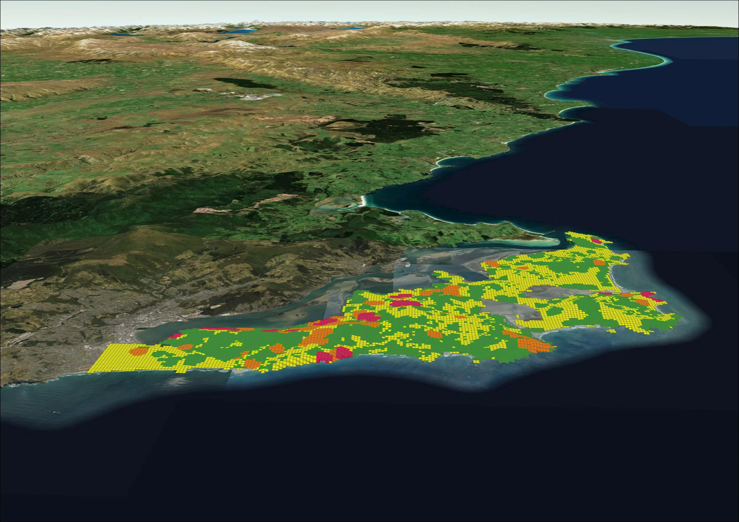
Possum ‘hotspots’ appear on the map after detections are logged, helping the team on the ground focus their resources.
Developed by Dr Mike Thorsen, the tool tackled a deceptively simple concept: had you looked, did you find anything, and how long ago was that? In eradication work, “we haven’t seen one lately” can mean two very different things - either the population is gone, or an animal (or two) is still there and slipping through gaps in effort. The tool estimated that likelihood when numbers were very low, and pinpointed where the team needed to keep trying.
In practice, it produced a traffic‑light map across the operational area – red through orange and yellow to green – showing where possums were most likely still present, and where accumulated effort supported confidence that they were not. For the nerdy readers, the model ran a temporal and spatial analysis of removal density compared with captures over the previous year. It looked for patterns in catches over time, which became valuable evidence when the team considered whether an area could be declared possum free.
The tool drew on a rich mix of inputs: trap data (via a Trap.nz API feed), camera detections, regular possum hotspot sweeps by Jonah and Scout (the scat detection dog), thermal drone sweeps in hard‑to‑access areas (including cliff terrain), and community‑reported possum sightings. It balanced traps and other search effort against possum detections to answer practical endgame questions: did they need to keep looking, how long after a detection did they persist, and how far out from where an animal was seen should the search extend?
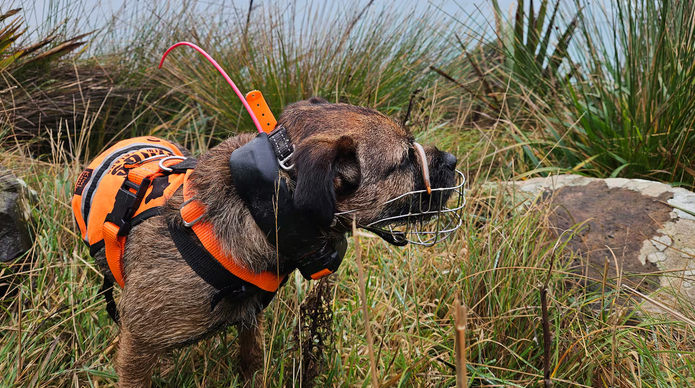
Regular sweeps by possum scat detection dog Scout fed into the model.
It also recognised that landscapes were not equal. Habitat layers were built in because possums were more likely to persist in some habitats than others – for example, bush or scrub compared with pasture – and that changed both risk and detectability. At low densities, the model also made the importance of consistent checking and reporting clear, because gaps in data could create blind spots.
In the early development phase, the tool was challenged by what teams were seeing on the ground - prompting reassessment of weighting and variables. That testing has strengthened the tool, with model outputs and field observations continually checked against each other and used to refine the settings.
While built for initial implementation for PFD on the Otago Peninsula, the concept is transferable. Mike notes it could be adopted by other predator free projects, provided they’re using a suite of detection techniques - because “proof of absence” is never one method, but the combined weight of evidence across tools. And if he had a magic wand? He’d plug in new forms of detection like environmental genetic signals - “air data” described as a dog’s nose for whether possums are in an area. “Or glow-in-the-dark possums. That would help with detection!” laughs Mike.